Char Dham Yatra Route Map & Distance Chart 2026-2027: Driving Times, Altitudes & Road Guide
SeetaNarayan Travels
Author

Planning the sacred Char Dham Yatra through the rugged Garhwal Himalayas requires precise navigational planning. Navigating mountain roads in Uttarakhand is vastly different from driving on plains highways—a distance of just 150 kilometers can take 6 to 8 hours due to winding switchbacks, river valley ascents, and high-altitude terrain.
Following the extensive upgrades under the Char Dham All-Weather Road Project (Char Dham Mahamarg), road widths, bypass tunnels, and slope stabilization have dramatically improved transit times across the circuit.
This definitive 2026–2027 navigation manual provides complete distance matrices, realistic driving hours, elevation charts, fuel/EV charging locations, and road condition insights to help you execute a safe and punctual pilgrimage.
The Traditional Clockwise Circuit: Order of Darshan
According to ancient Vedic traditions and geographical logic, the Char Dham Yatra is strictly undertaken in a clockwise (Pradakshina) direction, beginning in the west and concluding in the east:
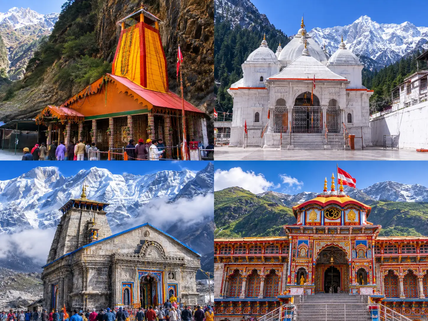
- Yamunotri Dham (West – Source of Yamuna River)
- Gangotri Dham (North-West – Spiritual Source of Ganga River)
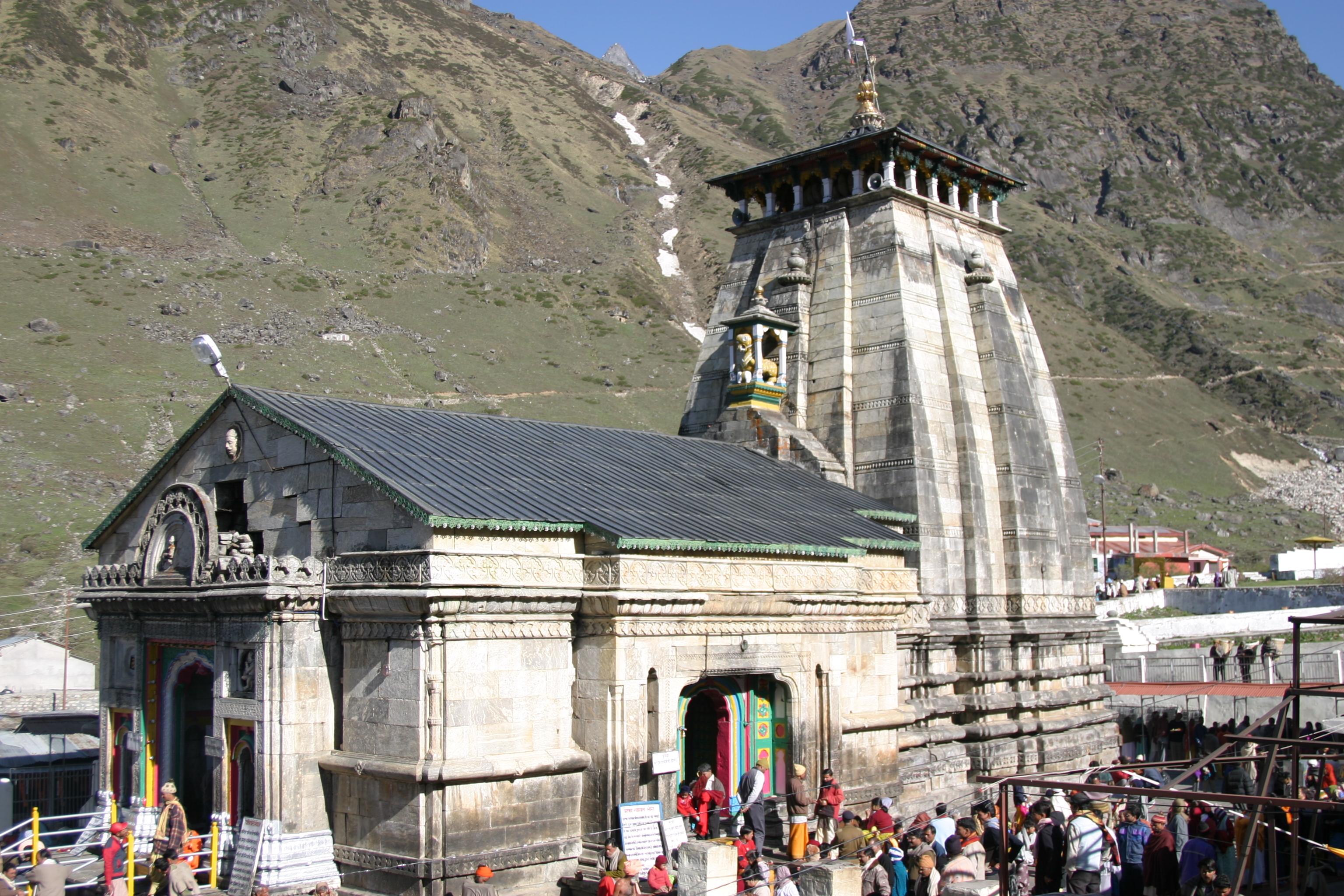
- Kedarnath Dham (Central – Abode of Lord Shiva)
- Badrinath Dham (East – Domain of Lord Vishnu)
Char Dham Distance & Driving Time Matrix (Ex-Haridwar / Rishikesh)
Below is the sector-by-sector breakdown of road distances and average mountain driving times under normal traffic conditions:
| Route Sector | Distance (km) | Average Driving Time | Key Towns / Waypoints |
|---|---|---|---|
| Haridwar / Rishikesh → Barkot | 175 km / 160 km | 6 – 7 Hours | Dehradun, Mussoorie, Kempty Falls, Nainbagh, Damta |
| Barkot → Janki Chatti (Base for Yamunotri) | 45 km | 2 Hours | Kharadi, Hanuman Chatti, Ranachatti |
| Janki Chatti → Yamunotri Temple (Trek) | 6 km (Trek) | 2.5 – 3.5 Hours | Bhairon Ghati, Surya Kund, Divya Shila |
| Barkot → Uttarkashi | 82 km | 3.5 – 4 Hours | Radi Top (2,290m), Dharasu Band, Brahmakhal |
| Uttarkashi → Gangotri Temple | 100 km | 4 – 4.5 Hours | Maneri Dam, Bhatwari, Harsil Valley, Dharali, Bhaironghati |
| Uttarkashi → Guptkashi (Kedarnath Base) | 200 km | 8 – 9 Hours | Chinyalisaur, Tehri Lake, Ghansali, Mayali, Tilwara |
| Guptkashi → Sonprayag / Gaurikund | 32 km | 1.5 Hours | Phata, Sersi, Rampur, Sitapur |
| Gaurikund → Kedarnath Temple (Trek) | 16 – 18 km (Trek) | 6 – 8 Hours | Jungle Chatti, Bheembali, Lincholi, Base Camp |
| Guptkashi → Joshimath / Pandukeshwar | 150 km | 6 – 7 Hours | Kund, Ukhimath, Chopta Ridge or Chamoli/Pipalkoti |
| Joshimath → Badrinath Temple | 45 km | 1.5 – 2 Hours | Vishnuprayag, Govindghat, Pandukeshwar, Hanuman Chatti |
| Badrinath → Rudraprayag | 160 km | 6 – 7 Hours | Joshimath, Chamoli, Nandaprayag, Karnaprayag |
| Rudraprayag → Rishikesh / Haridwar | 140 km / 165 km | 4.5 – 5.5 Hours | Srinagar (Garhwal), Devprayag, Byasi, Shivpuri |
Elevation & Altitude Profile of the Four Shrines
Understanding elevation is critical for pacing your yatra and preventing Acute Mountain Sickness (AMS):
- Haridwar / Rishikesh (Starting Point): 314m / 372m (1,030 ft / 1,220 ft)
- Yamunotri Temple: 3,293 meters (10,804 feet)
- Gangotri Temple: 3,100 meters (10,170 feet)
- Kedarnath Temple (Highest Shrine): 3,583 meters (11,755 feet)
- Badrinath Temple: 3,133 meters (10,279 feet)
Crucial Elevation Rule: Notice how the altitude increases progressively across the circuit. Spending initial nights at lower valley towns like Barkot (2,118m) and Uttarkashi (1,158m) naturally builds your body’s red blood cell count before ascending to the 3,500m+ heights of Kedarnath.
Key Road Conditions & Highway Safety Highlights (2026 Season)
- All-Weather Highway Status: The Rishikesh–Srinagar–Rudraprayag–Joshimath highway (NH-07) and the Dharasu–Gangotri highway (NH-34) feature wide, two-lane blacktopped roads with reinforced retaining walls.
- Chamba Tunnel & Radi Top Stretch: The 440-meter Chamba Tunnel eliminates severe bottleneck congestion. The high-altitude crossing at Radi Top between Barkot and Uttarkashi is fully paved, offering breathtaking Himalayan vistas.
- Sonprayag to Gaurikund Shuttle: Private tourist vehicles are strictly halted at Sonprayag. Only authorized local green-shuttle Maxx taxis are permitted on the final 5 km stretch to Gaurikund base.
Petrol Pumps, EV Charging Stations & ATM Availability
- Fuel Stations (Petrol & Diesel): Reliable Indian Oil, Bharat Petroleum, and HPCL fuel outlets are operational at Haridwar, Rishikesh, Chamba, Barkot, Uttarkashi, Harsil, Srinagar, Rudraprayag, Guptkashi, Pipalkoti, and Joshimath. There are no petrol pumps between Joshimath and Badrinath or between Gaurikund and Kedarnath. Always top up your tank whenever you cross a half-tank mark.
- EV Charging Stations: Fast DC chargers under the Uttarakhand EV infrastructure initiative are installed at Rishikesh, Tehri, Uttarkashi, Srinagar, and Joshimath.
- ATMs & Cash Requirements: While digital payments (UPI) work across major towns, mobile data can fluctuate in deep gorges. Carry at least ₹10,000 to ₹15,000 in physical cash for local pony/palki tokens and emergency purchases.
Mobile Network Coverage Across the Circuit
- Jio & Airtel: Deliver strong 4G/5G data connectivity across Haridwar, Rishikesh, Uttarkashi, Guptkashi, Joshimath, Badrinath, and even at the Kedarnath Temple premises.
- BSNL: Provides the widest backup network in remote high-altitude trails, including Bhaironghati, Harsil, and the Kedarnath trek path.
- Vodafone-Idea (Vi): Good coverage up to major base towns, but intermittent in high mountain gorges.
Frequently Asked Questions
What is the total road distance for the complete Char Dham circuit?
Starting and ending in Haridwar or Rishikesh, the complete road yatra covers approximately 1,600 to 1,750 kilometers over 10 to 12 days, including local approach roads and detours.
Are night drives permitted on the Char Dham mountain roads?
No. For passenger safety, the Uttarakhand government strictly enforces gate timings (no commercial hill driving allowed between 8:00 PM and 5:00 AM) to prevent accidents caused by fatigue, wildlife movement, or overnight rockfall.
Can beginners self-drive on the Char Dham highway?
While the roads are wide, mountain driving requires disciplined engine braking, defensive overtaking on sharp blind curves, and familiarity with yielding to uphill traffic. Hiring an experienced hill driver is strongly advised.
Plan Your Safe Pilgrimage with SeetaNarayan Travels
Navigating mountain check-posts, booking verified accommodations with guaranteed parking, and scheduling temple darshans requires proven on-ground operational mastery.
At SeetaNarayan Travels, our fleet of rigorously inspected, hill-certified vehicles (Toyota Innova Crysta, Tempo Travellers, and luxury coaches) are piloted exclusively by veteran local drivers with decades of Himalayan experience.
Explore our Services, view upcoming Fixed Departures, or Contact Us Today to plan your 2026–2027 Char Dham pilgrimage.